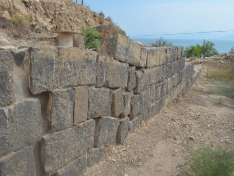
Archaeological features show evidence of a strong earthquake in northern Israel in the mid-8th century, although the plate boundary responsible hasn’t produced any large shakes since seismologists began measuring the area about a century ago.
The discovery shows that the Sea of Galilee region may have a higher risk of strong earthquakes than currently believed.
“We already knew that we are in a region where earthquakes occurred,” said Francesca Ferrario, a geoscientist at the University of Insubria in Italy and lead author of the new study. In fact, devastating earthquakes occur in the area in intervals spanning from hundreds to thousands of years.
But seismic measurements in this area started only at the beginning of the 20th century and have detected no large earthquake. In the new study, Ferrario et al. examined archaeological records looking for evidence of large seismic events in the past.
The city of Tiberias, on the western shore of the Sea of Galilee, grew into a large urban area about 2 millennia ago during Roman rule of the area. Over the centuries that followed, Tiberias was involved in conflicts between Byzantine, Persian, Jewish, and Muslim forces. In 749, the city was controlled by the Umayyad dynasty when a major earthquake destroyed the nearby town of Bet She’an and caused heavy damage in Tiberias itself, according to historical sources.
Ferrario worked with the Geological Survey of Israel and archaeologists at the Israel Antiquities Authority in surveying Tiberias’s Roman-Byzantine era ruins. They looked for evidence of the earthquake at three sites: a theater, a gate, and a water reservoir.

Damage at the theater included evidence of vertical fault displacement (mainly in the form of downthrown seating rows and walls) and permanent ground deformation (in the form of tilted and folded walls). Displacement also affected the flooring, and sediments were laid out evenly across the area except for the fault zone, which was a few meters wide. The southern gate shows warping of a Byzantine wall.
Ferrario said the evidence documents the existence of normal faulting under Tiberias and the surrounding area. This evidence is added to normal faulting previously studied along the western shore of the Sea of Galilee. Calculations showed the 749 earthquake likely measured somewhere between 6.9 and 7.6 in magnitude.
Multifault Ruptures Likely
The authors say the geological evidence shows that multifault ruptures are likely more common than single-fault ruptures in the region.
“The absence of instrumental measurements of strong (Mw greater than 6.0) earthquakes with normal fault focal mechanism should not be construed as evidence that similar events will never occur along this section of the Dead Sea Fault,” the authors said in the study.
Ferrario said this knowledge can be used to make safer development plans in the area in case another earthquake does occur.
“Our study can be useful for updating regulation building codes and structures,” she said. (Tectonics, https://doi.org/10.1029/2020TC006186, 2020)
—Joshua Rapp Learn (@JoshuaLearn1), Science Writer
The Link LonkOctober 05, 2020 at 06:55PM
https://ift.tt/2GyR7wl
Ancient Ruins Reveal 8th Century Earthquake in Sea of Galilee - Eos
https://ift.tt/2CoSmg4
Sea
/cloudfront-us-east-2.images.arcpublishing.com/reuters/CZF6NULMVVMEXHOP7JK5BSPQUM.jpg)
No comments:
Post a Comment